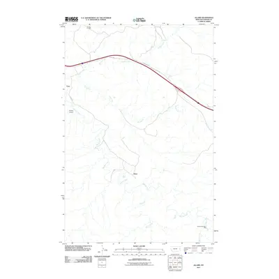
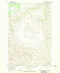
2011 Map of Allard
USGS Topo · Published 2011About this map
Allard and Curry sit within a landscape defined by the intricate drainage of the Glendive Creek system in Dawson County. This 2011 survey reveals a quiet corner of eastern Montana where modern infrastructure, such as Frontage Rd and Road 300, intersects with historical resource extraction at the Burning Coal Mine. The terrain is deeply textured by erosion, most notably at Kinney Coulee and along the winding banks of Krug Creek and Griffith Creek.
Find a feature on this map
15 named features on this map. Tap any name to fly to it.
Don’t see what you’re looking for? This feature index may not catch every label — zoom into the map to look around manually.
Map Details
Editions of this 2011 Allard Map
This is the sole edition of this map. No revisions or reprints were ever made.
Other maps of this area

1909 · Glendive
USGS Topo · 1:250,000

1953 · Miles City
USGS Topo · 1:250,000
1954 · Glendive
USGS Topo · 1:250,000
1957 · Miles City
USGS Topo · 1:250,000
1957 · Glendive
USGS Topo · 1:250,000
1958 · Miles City
USGS Topo · 1:250,000
1958 · Glendive
USGS Topo · 1:250,000
1967 · Stipek
USGS Topo · 1:24,000
1967 · Allard
USGS Topo · 1:24,000
1967 · Belle Prairie
USGS Topo · 1:24,000