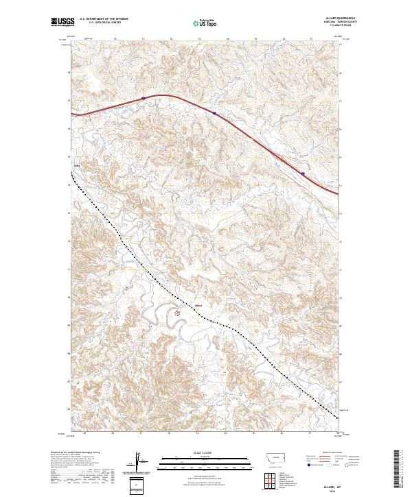
2024 Map of Allard
USGS Topo · Published 2024About this map
Glendive Creek meanders through the central landscape of this Dawson County region, following a winding path that reveals the area's natural drainage patterns. The small settlement of Allard sits centrally within the township boundaries of T15N R56E and T15N R57E, serving as a quiet focal point in a territory defined by its complex network of waterways. To the northwest, the location of Curry is positioned near the upper reaches of the creek system. Transport in the northern portion of the quadrangle is anchored by the presence of Frontage Rd, which runs parallel to the interstate corridor, while smaller local routes like Rd 106 and Rd 322 provide access to the surrounding uplands. A series of smaller tributaries, including Griffith Creek, Krug Creek, and Frank Creek, carve through the terrain, illustrating the hydrologic character of the Montana plains.
Find a feature on this map
17 named features on this map. Tap any name to fly to it.
Don’t see what you’re looking for? This feature index may not catch every label — zoom into the map to look around manually.
Map Details
Editions of this 2024 Allard Map
This is the sole edition of this map. No revisions or reprints were ever made.
Other maps of this area

1909 · Glendive
USGS Topo · 1:250,000

1953 · Miles City
USGS Topo · 1:250,000

1954 · Glendive
USGS Topo · 1:250,000

1957 · Miles City
USGS Topo · 1:250,000

1957 · Glendive
USGS Topo · 1:250,000

1958 · Miles City
USGS Topo · 1:250,000

1958 · Glendive
USGS Topo · 1:250,000

1967 · Stipek
USGS Topo · 1:24,000

1967 · Allard
USGS Topo · 1:24,000

1967 · Belle Prairie
USGS Topo · 1:24,000