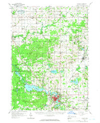
1958 Map of Allegan
USGS Topo · Published 1966About this map
The Kalamazoo River and the sprawling Lake Allegan anchor this mid-century portrait of Michigan's Allegan County, where the city of Allegan sits at the confluence of water and rail. The New York Central line threads through the landscape, connecting the county seat to outlying settlements like Hopkins and Hamilton. Evidence of the region’s diverse economy is visible in the extensive oil and gas fields scattered across the northern townships and the numerous gravel pits supporting local infrastructure.
Find a feature on this map
103 named features on this map. Tap any name to fly to it.
Don’t see what you’re looking for? This feature index may not catch every label — zoom into the map to look around manually.
Map Details
Editions of this 1958 Allegan Map
2 editions found

Other maps of this area

1914 · Grand Rapids
USGS Topo · 1:62,500

1916 · Kalamazoo
USGS Topo · 1:62,500

1918 · Kalamazoo
USGS Topo · 1:62,500

1927 · Bangor
USGS Topo · 1:62,500

1928 · Fennville
USGS Topo · 1:62,500

1929 · Holland
USGS Topo · 1:62,500

1931 · Fennville
USGS Topo · 1:62,500

1931 · Bangor
USGS Topo · 1:62,500

1932 · Holland
USGS Topo · 1:62,500

1943 · Kalamazoo
USGS Topo · 1:62,500