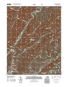
2011 Map of Alleghany
USGS Topo · Published 2011About this map
Old Sweet Springs and the historic Sweet Springs Valley anchor this topographical survey of the border region between Virginia and West Virginia. The landscape is defined by its namesake mineral springs, including Sweet Chalybeate Springs and Iron Hill Springs, which were the foundation of the area's development as a resort and health destination. The rugged topography is etched with deep hollows like Tucker Hollow and Falls Hollow, while the Lewis Tunnel provides a vital passage through the mountains. Genealogists will find notable value in the location of the Lewis Tunnel Cemetery and Carter Cemetery, as well as the position of the Sweet Springs Post Office. Small settlements such as Hematite, Crows, and Earlehurst are scattered along the narrow valleys carved by Dunlap Creek and Potts Creek.
Find a feature on this map
61 named features on this map. Tap any name to fly to it.
Don’t see what you’re looking for? This feature index may not catch every label — zoom into the map to look around manually.
Map Details
Editions of this 2011 Alleghany Map
This is the sole edition of this map. No revisions or reprints were ever made.
Other maps of this area

1887 · Lewisburg
USGS Topo · 1:125,000

1891 · Lewisburg
USGS Topo · 1:125,000

1921 · Callaghan
USGS Topo · 1:48,000

1921 · White Sulphur Springs
USGS Topo · 1:48,000

1921 · Ronceverte
USGS Topo · 1:48,000

1923 · White Sulphur Springs
USGS Topo · 1:62,500

1923 · Ronceverte
USGS Topo · 1:62,500

1923 · Callaghan
USGS Topo · 1:62,500

1935 · White Sulphur Springs
USGS Topo · 1:62,500

1939 · White Sulphur Springs
USGS Topo · 1:62,500