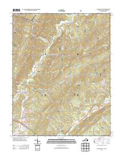
2013 Map of Alleghany
USGS Topo · Published 2013About this map
Sweet Springs and the surrounding valley define this borderland where Virginia and West Virginia meet. This 2013 survey documents a landscape historically centered on its medicinal waters, featuring Old Sweet Springs and the nearby Rowan Memorial Home Spring. To the north, the small settlement of Sweet Chalybeate sits near Sweet Chalybeate Springs, reflecting the era's reliance on these mineral sites. The terrain is marked by prominent ridges like Sweet Springs Mountain and Snake Run Ridge, which forced transportation routes through gaps like the Lewis Tunnel near Alleghany. Other small clusters such as Earlehurst, Crows, and Hematite are connected by winding roads that follow the contours of Dunlap Creek and Potts Creek, illustrating a classic Appalachian pattern of hollow-and-ridge settlement.
Find a feature on this map
70 named features on this map. Tap any name to fly to it.
Don’t see what you’re looking for? This feature index may not catch every label — zoom into the map to look around manually.
Map Details
Editions of this 2013 Alleghany Map
This is the sole edition of this map. No revisions or reprints were ever made.
Other maps of this area

1887 · Lewisburg
USGS Topo · 1:125,000

1891 · Lewisburg
USGS Topo · 1:125,000

1921 · Callaghan
USGS Topo · 1:48,000

1921 · White Sulphur Springs
USGS Topo · 1:48,000

1921 · Ronceverte
USGS Topo · 1:48,000

1923 · White Sulphur Springs
USGS Topo · 1:62,500

1923 · Ronceverte
USGS Topo · 1:62,500

1923 · Callaghan
USGS Topo · 1:62,500

1935 · White Sulphur Springs
USGS Topo · 1:62,500

1939 · White Sulphur Springs
USGS Topo · 1:62,500