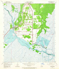
1952 Map of Allemands
USGS Topo · Published 1964About this map
The Petit Lac Des Allemands and the winding Bayou Des Allemands define this early 1950s landscape on the boundary of St. Charles and Lafourche Parishes. The settlement of Allemands serves as a central hub where the Southern Pacific railroad crosses the water, neighboring the smaller communities of Vallier and Cypres. This era shows a transition from traditional bayou life to industrial extraction, evidenced by the extensive Paradis Oil Field with its grid of numbered canals, such as Canal No 24 and Canal No 12, and several Oil Tanks. Local heritage is anchored by landmarks like Antioch Ch, Shell-Mound Sch, and the Shell Mound Cem, providing valuable touchpoints for genealogists. To the south, the intricate wetlands of Simeneaux Ponds and Dufrene Ponds surround Black Prince Island, illustrating the complex hydrology of the Louisiana basin.
Find a feature on this map
52 named features on this map. Tap any name to fly to it.
Don’t see what you’re looking for? This feature index may not catch every label — zoom into the map to look around manually.
Map Details
Editions of this 1952 Allemands Map
2 editions found
Other maps of this area

1891 · Hahnville
USGS Topo · 1:62,500

1892 · Lac Des Allemands
USGS Topo · 1:62,500

1892 · Cut-Off
USGS Topo · 1:62,500

1892 · Houma
USGS Topo · 1:62,500

1932 · Lac Des Allemands SE
USGS Topo · 1:31,680

1932 · Houma NE
USGS Topo · 1:31,680

1932 · Hahnville NW
USGS Topo · 1:31,680

1932 · Lac Des Allemands NE
USGS Topo · 1:31,680

1932 · Hahnville SW
USGS Topo · 1:31,680

1932 · Hahnville NE
USGS Topo · 1:31,680