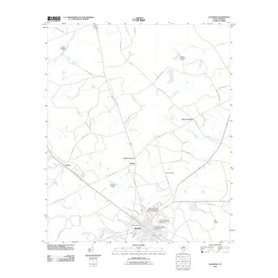
2011 Map of Allendale
USGS Topo · Published 2011About this map
Allendale serves as the primary hub of this 2011 quadrangle, showcasing a detailed grid of local streets like Bluff Rd and Mixson St. The presence of the University of South Carolina Salkehatchie - Main Campus and the Allendale Post Office indicates the town's role as an educational and civic center for the region. The surrounding landscape is characterized by a network of drainage features and crossroads, including Grays Crossroads and Hayes Crossroads, which anchor the smaller outlying communities of Appleton and Seigling.
Find a feature on this map
64 named features on this map. Tap any name to fly to it.
Don’t see what you’re looking for? This feature index may not catch every label — zoom into the map to look around manually.
Map Details
Editions of this 2011 Allendale Map
This is the sole edition of this map. No revisions or reprints were ever made.
Other maps of this area

1918 · Varnville
USGS Topo · 1:62,500

1919 · Olar
USGS Topo · 1:62,500

1919 · Allendale
USGS Topo · 1:62,500

1920 · Peeples
USGS Topo · 1:62,500

1943 · Olar
USGS Topo · 1:62,500

1943 · Allendale
USGS Topo · 1:62,500

1943 · Peeples
USGS Topo · 1:62,500

1944 · Varnville
USGS Topo · 1:62,500

1947 · Savannah
USGS Topo · 1:250,000

1948 · Savannah
USGS Topo · 1:250,000