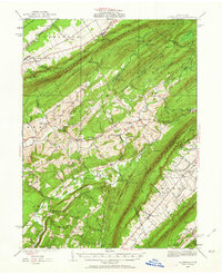
1935 Map of Allensville
USGS Topo · Published 1963About this map
Tussey Mountain and Stone Mountain frame the deep agricultural valleys of central Pennsylvania in this mid-1930s survey. The landscape is a network of small upland communities and rural infrastructure, from the industrial heritage at Monroe Furnace to the local milling operations at Cornpropst Mill. The presence of the CCC Camp at Owl Gap and the State College Camp near Sand Knob reflects the era's conservation efforts within the forested ridges of Harris Mountain.
Find a feature on this map
134 named features on this map. Tap any name to fly to it.
Don’t see what you’re looking for? This feature index may not catch every label — zoom into the map to look around manually.
Map Details
Editions of this 1935 Allensville Map
2 editions found

Other maps of this area

1901 · Huntingdon
USGS Topo · 1:62,500

1904 · Huntingdon
USGS Topo · 1:62,500

1908 · Bellefonte
USGS Topo · 1:62,500

1909 · Bellefonte
USGS Topo · 1:62,500

1919 · Mattawana
USGS Topo · 1:62,500

1919 · Menno
USGS Topo · 1:62,500

1922 · Mt Union
USGS Topo · 1:48,000

1922 · Philipsburg
USGS Topo · 1:62,500

1923 · Tyrone
USGS Topo · 1:62,500

1924 · Mt. Union
USGS Topo · 1:62,500