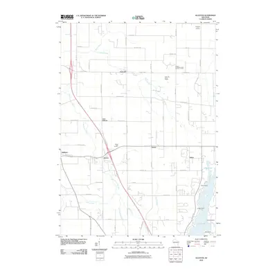
2010 Map of Allenton
USGS Topo · Published 2010About this map
Allenton serves as a central hub on this 2010 survey, situated at the junction of the East Branch Rock River and the corridor carrying the Yellowstone Trl. The landscape reflects a transition between clustered rural settlements like Kohlsville and Saint Anthony and the more recreational southeastern geography around Cedar Lake. This area of Washington County maintains a strong connection to its pioneer-era foundations, visible through the distribution of community anchors such as the Sacred Heart Cemetery and the Albright Evangelical United Brethren Cemetery.
Find a feature on this map
66 named features on this map. Tap any name to fly to it.
Don’t see what you’re looking for? This feature index may not catch every label — zoom into the map to look around manually.
Map Details
Editions of this 2010 Allenton Map
This is the sole edition of this map. No revisions or reprints were ever made.
Other maps of this area

1904 · West Bend
USGS Topo · 1:62,500

1904 · Hartford
USGS Topo · 1:62,500

1955 · Campbellsport
USGS Topo · 1:62,500

1955 · Kewaskum
USGS Topo · 1:62,500

1957 · Madison
USGS Topo · 1:250,000

1959 · West Bend
USGS Topo · 1:62,500

1959 · Hartford
USGS Topo · 1:62,500

1959 · Nenno
USGS Topo · 1:24,000

1959 · Allenton
USGS Topo · 1:24,000
1959 · Jackson
USGS Topo · 1:24,000