
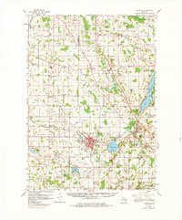
1959 Map of Hartford
USGS Topo · Published 1961About this map
The Hartford community serves as the industrial and social anchor of this 1959 survey, situated near the headwaters of the Rubicon River. The landscape reveals a transition between rural dairy lands and burgeoning lakeside developments, particularly around Big Cedar Lake and Pike Lake. Transport networks are defined by the convergence of the Chicago Milwaukee ST Paul And Pacific and the Minneapolis ST Paul And Sault Ste Marie railroads, which facilitated the growth of smaller hamlets like Allenton and Slinger.
Find a feature on this map
92 named features on this map. Tap any name to fly to it.
Don’t see what you’re looking for? This feature index may not catch every label — zoom into the map to look around manually.
Map Details
Editions of this 1959 Hartford Map
2 editions found
Other maps of this area

1892 · Waukesha
USGS Topo · 1:62,500

1892 · Watertown
USGS Topo · 1:62,500

1892 · Oconomowoc
USGS Topo · 1:62,500

1894 · Watertown
USGS Topo · 1:62,500

1901 · Waukesha
USGS Topo · 1:62,500

1904 · West Bend
USGS Topo · 1:62,500

1904 · Hartford
USGS Topo · 1:62,500

1906 · Waukesha
USGS Topo · 1:62,500

1909 · Oconomowoc
USGS Topo · 1:62,500

1955 · Waupun
USGS Topo · 1:62,500