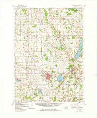
1959 Map of Hartford
USGS Topo · Published 1980About this map
The Rubicon River and Ashippun River valley define the southern half of this landscape, anchoring the bustling rail hub of Hartford. By the late 1950s, the region was characterized by its dense network of rural schools and church-related landmarks, including Zion Sch, St Johns Ch, and the uniquely named Christs Manger Sch Cem. Local industry is evidenced by the prolific distribution of Gravel Pits and the presence of the Neosho Millpond.
Find a feature on this map
104 named features on this map. Tap any name to fly to it.
Don’t see what you’re looking for? This feature index may not catch every label — zoom into the map to look around manually.
Map Details
Editions of this 1959 Hartford Map
2 editions found

Other maps of this area

1892 · Waukesha
USGS Topo · 1:62,500

1892 · Watertown
USGS Topo · 1:62,500

1892 · Oconomowoc
USGS Topo · 1:62,500

1894 · Watertown
USGS Topo · 1:62,500

1901 · Waukesha
USGS Topo · 1:62,500

1904 · West Bend
USGS Topo · 1:62,500

1904 · Hartford
USGS Topo · 1:62,500

1906 · Waukesha
USGS Topo · 1:62,500

1909 · Oconomowoc
USGS Topo · 1:62,500

1955 · Waupun
USGS Topo · 1:62,500