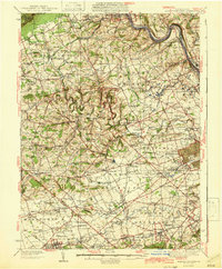
1942 Map of Allentown West
USGS Topo · Published 1942About this map
Blue Mountain and the prominent Bake Oven Knob anchor the northern reaches of this landscape, overlooking a dense network of farming townships and early industrial settlements in the years leading into the Second World War. The area is defined by its numerous small schoolhouses, such as the Mantz Sch and Hynemansville Sch, and its religious centers like Ziegels Ch. Settlement patterns follow the winding paths of Jordan Creek and Little Lehigh Creek, where the Reading Railroad and Ironton Railroad once connected local commerce to the larger Pennsylvania markets. Significant landmarks of the era include the Trexler Game Preserve and the Trexler Orchard Pack House, alongside established institutions like Cedar Crest College and the Lehigh County Home. From the crossroads at Leather Corner Post to the varied small villages like Fogelsville and New Smithville, the map reveals a meticulously surveyed view of Lehigh and Berks counties before post-war suburban expansion.
Find a feature on this map
159 named features on this map. Tap any name to fly to it.
Don’t see what you’re looking for? This feature index may not catch every label — zoom into the map to look around manually.
Map Details
Editions of this 1942 Allentown West Map
3 editions found

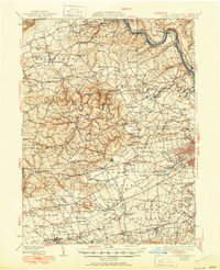
Other maps of this area

1888 · Quakertown
USGS Topo · 1:62,500

1889 · Hazleton
USGS Topo · 1:62,500

1890 · Quakertown
USGS Topo · 1:62,500

1891 · Hazleton
USGS Topo · 1:62,500

1893 · Hazleton
USGS Topo · 1:62,500

1894 · Reading
USGS Topo · 1:62,500

1894 · Allentown
USGS Topo · 1:62,500

1894 · Quakertown
USGS Topo · 1:62,500

1902 · Boyertown
USGS Topo · 1:62,500

1902 · Slatington
USGS Topo · 1:62,500