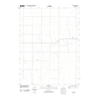
2009 Map of Allison
USGS Topo · Published 2009About this map
The North Fork Solomon River meanders across this rural Decatur County landscape, carving a subtle path through the agricultural grid of Northwest Kansas. The small settlement of Allison serves as a local anchor along the river valley, reflecting the late 20th and early 21st-century rural layout of the region. This 2009 survey highlights a classic Great Plains section-line road network, anchored by routes like Co RD 509 and Co RD 503. Genealogists and local researchers will find the Adell Cemetery documented in detail south of the river, providing a precise spatial record of this community landmark within the wider prairie environment.
Find a feature on this map
5 named features on this map. Tap any name to fly to it.
Don’t see what you’re looking for? This feature index may not catch every label — zoom into the map to look around manually.
Map Details
Editions of this 2009 Allison Map
This is the sole edition of this map. No revisions or reprints were ever made.
Other maps of this area

1954 · Goodland
USGS Topo · 1:250,000

1956 · Goodland
USGS Topo · 1:250,000

1957 · Goodland
USGS Topo · 1:250,000

1978 · Clayton SW
USGS Topo · 1:24,000

1978 · Clayton
USGS Topo · 1:24,000
1978 · Dresden North
USGS Topo · 1:24,000
1978 · Jennings
USGS Topo · 1:24,000

1978 · Allison
USGS Topo · 1:24,000

1978 · Dresden South
USGS Topo · 1:24,000

1979 · Lucerne
USGS Topo · 1:24,000