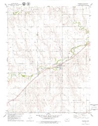
1978 Map of Jennings
USGS Topo · Published 1979About this map
Jennings serves as the central hub of this northwestern Kansas landscape, situated at the confluence of transport and industry in the late 1970s. The town is anchored by the Chicago Rock Island and Pacific railroad line, which cuts diagonally across the terrain, paralleling the course of Prairie Dog Creek. The map reveals a diversified rural economy where traditional agriculture meets energy extraction, evidenced by the extensive Oil Field and numerous Oil Wells scattered across the northern townships of Altory and Garfield. Local infrastructure is well-defined, from the Jennings Cem on the outskirts of town to the Wt and several Sandpit locations. The natural topography is marked by the broad Pleasant Valley and the winding path of Big Timber Creek, illustrating the drainage patterns that have historically shaped settlement in Decatur County.
Find a feature on this map
18 named features on this map. Tap any name to fly to it.
Don’t see what you’re looking for? This feature index may not catch every label — zoom into the map to look around manually.
Map Details
Editions of this 1978 Jennings Map
This is the sole edition of this map. No revisions or reprints were ever made.
Other maps of this area

1951 · Norcatur
USGS Topo · 1:62,500

1951 · Kanona
USGS Topo · 1:62,500

1954 · Goodland
USGS Topo · 1:250,000

1956 · Goodland
USGS Topo · 1:250,000

1957 · Goodland
USGS Topo · 1:250,000

1965 · Kanona SE
USGS Topo · 1:24,000

1965 · Kanona
USGS Topo · 1:24,000

1978 · Clayton SW
USGS Topo · 1:24,000

1978 · Clayton
USGS Topo · 1:24,000
1978 · Dresden North
USGS Topo · 1:24,000