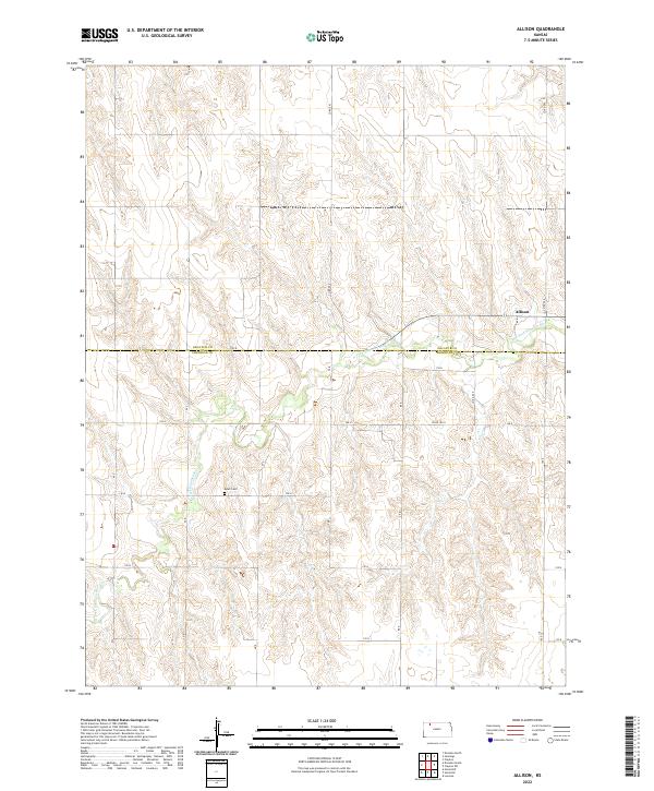
2022 Map of Allison
USGS Topo · Published 2022About this map
The N Fork Solomon River meanders across this rural landscape where the border of Decatur and Sheridan Counties meets. This area of northwest Kansas is characterized by deeply incised drainages and high plains topography, centered on the small settlement of Allison. Local history and genealogy are anchored by Adell Cem, a lonely landmark on the plateau overlooking the river valley. The map reveals the strictly organized grid of the Public Land Survey System, with township and range lines like t5s r27w and t6s r26w defining the administrative geography. Movement through this section of the High Plains is facilitated by a network of county roads, including Co Rd 503 and Co Rd 140 N, which follow the section lines and connect the sparse farmsteads dotting the uplands between the river's forks.
Find a feature on this map
12 named features on this map. Tap any name to fly to it.
Don’t see what you’re looking for? This feature index may not catch every label — zoom into the map to look around manually.
Map Details
Editions of this 2022 Allison Map
This is the sole edition of this map. No revisions or reprints were ever made.
Other maps of this area

1954 · Goodland
USGS Topo · 1:250,000

1956 · Goodland
USGS Topo · 1:250,000

1957 · Goodland
USGS Topo · 1:250,000

1978 · Clayton SW
USGS Topo · 1:24,000

1978 · Clayton
USGS Topo · 1:24,000
1978 · Dresden North
USGS Topo · 1:24,000
1978 · Jennings
USGS Topo · 1:24,000

1978 · Allison
USGS Topo · 1:24,000

1978 · Dresden South
USGS Topo · 1:24,000

1979 · Lucerne
USGS Topo · 1:24,000