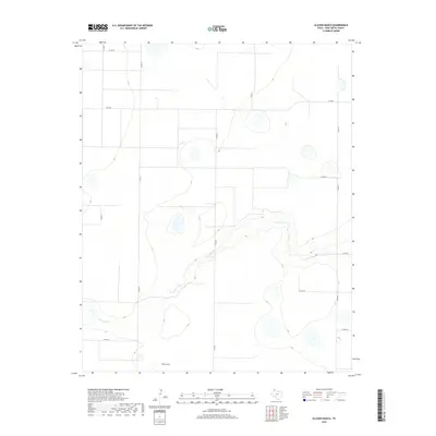
2019 Map of Allison Ranch
USGS Topo · Published 2019About this map
Palo Duro Cr cuts a distinct, winding path through this portion of Deaf Smith County, carving a series of depressions and drainage patterns into the High Plains. The landscape is defined by the agricultural layout of the Panhandle, where a rigid grid of county roads, such as Co Rd EE and Co Rd FF, organizes the territory into large sections typical of ranching and farming country. Near the southern edge of the survey, Allison Ranch stands as a primary landmark in a region characterized by its expansive open spaces and scattered natural basins. This map illustrates the intersection of modern rural infrastructure, like Fm 2587, with the natural hydrology of the basin, showing how human development adheres to the geometric patterns of the Texas land system.
Find a feature on this map
13 named features on this map. Tap any name to fly to it.
Don’t see what you’re looking for? This feature index may not catch every label — zoom into the map to look around manually.
Map Details
Editions of this 2019 Allison Ranch Map
This is the sole edition of this map. No revisions or reprints were ever made.
Other maps of this area

1954 · Tucumcari
USGS Topo · 1:250,000

1954 · Clovis
USGS Topo · 1:250,000

1958 · Clovis
USGS Topo · 1:250,000

1958 · Tucumcari
USGS Topo · 1:250,000

1961 · Buffalo Lake
USGS Topo · 1:62,500

1962 · Wildorado
USGS Topo · 1:62,500

1965 · Everett
USGS Topo · 1:24,000

1965 · Allison Ranch
USGS Topo · 1:24,000

1966 · Vega South
USGS Topo · 1:24,000

1966 · Ford
USGS Topo · 1:24,000