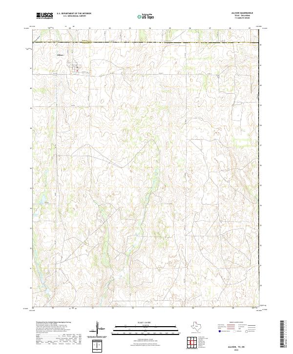
2022 Map of Allison
USGS Topo · Published 2022About this map
Allison sits at the northwestern edge of this landscape, positioned along the border between Hemphill and Wheeler counties. The town is organized around a small grid of streets including 2nd St and the intersecting FM 1046, reflecting the characteristic layout of rural Texas Panhandle settlements. This area is defined by its intermittent drainage patterns, with Murtaugh Cr and Mulberry Draw carving through the terrain towards the southeast. Smaller water features such as Rathjen Springs and Frye Lakes provide essential hydrological markers in an otherwise semi-arid environment. The road network, including the aptly named Santa Fe Rd, suggests the historical influence of regional transportation corridors that supported the local ranching and agricultural economy during this era.
Find a feature on this map
24 named features on this map. Tap any name to fly to it.
Don’t see what you’re looking for? This feature index may not catch every label — zoom into the map to look around manually.
Map Details
Editions of this 2022 Allison Map
This is the sole edition of this map. No revisions or reprints were ever made.
Other maps of this area

1954 · Amarillo
USGS Topo · 1:250,000

1955 · Clinton
USGS Topo · 1:250,000

1957 · Clinton
USGS Topo · 1:250,000

1958 · Amarillo
USGS Topo · 1:250,000

1960 · Sweetwater
USGS Topo · 1:62,500

1961 · Reydon
USGS Topo · 1:62,500

1963 · Allison
USGS Topo · 1:24,000

1963 · Kelton
USGS Topo · 1:24,000

1963 · Kelton NW
USGS Topo · 1:24,000

1963 · Allison SW
USGS Topo · 1:24,000