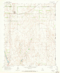
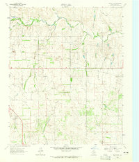
1963 Map of Allison
USGS Topo · Published 1965About this map
Allison stands as the primary community in this 1963 survey of the Texas Panhandle, positioned just south of the Hemphill Co Wheeler Co line. The landscape is defined by the high plains drainage system, where the seasonal flows of Mulberry Draw and Murlaugh Creek shape the topography. Transportation and commerce are centered on the Panhandle and Santa Fe railroad, which cuts across the northern section of the quadrangle to serve the local agricultural economy. To the south, water management is evident at Frye Lakes, featuring distinct engineering markers such as Spillway Elev 2304 and Spillway Elev 2276. This map provides a clear record of the rural infrastructure and property divisions along the Texas Oklahoma state border during the mid-twentieth century.
Find a feature on this map
12 named features on this map. Tap any name to fly to it.
Don’t see what you’re looking for? This feature index may not catch every label — zoom into the map to look around manually.
Map Details
Editions of this 1963 Allison Map
This is the sole edition of this map. No revisions or reprints were ever made.
Other maps of this area

1954 · Amarillo
USGS Topo · 1:250,000

1955 · Clinton
USGS Topo · 1:250,000

1957 · Clinton
USGS Topo · 1:250,000

1958 · Amarillo
USGS Topo · 1:250,000
1960 · Sweetwater
USGS Topo · 1:62,500
1961 · Reydon
USGS Topo · 1:62,500
1963 · Kelton
USGS Topo · 1:24,000
1963 · Kelton NW
USGS Topo · 1:24,000
1963 · Allison SW
USGS Topo · 1:24,000
1967 · Hackberry Creek
USGS Topo · 1:24,000