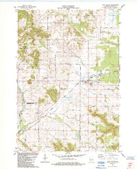
1984 Map of Alma Center
USGS Topo · Published 1984About this map
The village of Alma Center stands as a focal point in Jackson County during the mid-1980s, positioned along the Chicago and North Western rail line and the South Fork Halls Creek. This survey reveals a landscape deeply connected to its agricultural and geological roots, evidenced by the numerous cemeteries like Stanford Cem and Houghtonburg Cem that mark the township boundaries of Garden Valley, Alma, and Hixton. Notable terrain features include the prominent Silver Mound and the protected lands of the North Branch Trempealeau R State Fishery Area.
Find a feature on this map
47 named features on this map. Tap any name to fly to it.
Don’t see what you’re looking for? This feature index may not catch every label — zoom into the map to look around manually.
Map Details
Editions of this 1984 Alma Center Map
This is the sole edition of this map. No revisions or reprints were ever made.
Other maps of this area

1924 · Black River Falls
USGS Topo · 1:62,500

1926 · Black River Falls
USGS Topo · 1:62,500

1927 · Blair
USGS Topo · 1:62,500

1935 · Osseo
USGS Topo · 1:48,000

1940 · Osseo
USGS Topo · 1:62,500

1948 · Fairchild
USGS Topo · 1:62,500

1949 · Fairchild
USGS Topo · 1:62,500

1953 · Eau Claire
USGS Topo · 1:250,000

1958 · Eau Claire
USGS Topo · 1:250,000

1964 · Eau Claire
USGS Topo · 1:250,000