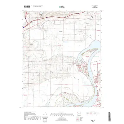
2020 Map of Alma
USGS Topo · Published 2020About this map
Alma and the surrounding Arkansas river valley lands appear here as a landscape shaped by historical waterways and modern infrastructure. The Missouri Pacific RR runs through the northern settlements, passing by Dyer and the northern outskirts of Alma, while Lake Alma serves as a prominent landmark just north of the city center. To the south, the terrain transitions into the complex oxbows and sloughs of the Arkansas River, where Frog Bayou meets Ozark Lake.
Find a feature on this map
110 named features on this map. Tap any name to fly to it.
Don’t see what you’re looking for? This feature index may not catch every label — zoom into the map to look around manually.
Map Details
Editions of this 2020 Alma Map
This is the sole edition of this map. No revisions or reprints were ever made.
Other maps of this area

1879 · Fort Smith
USGS Topo · 1:62,500

1887 · Van Buren
USGS Topo · 1:62,500

1890 · Fort Smith
USGS Topo · 1:125,000

1898 · Winslow #4
USGS Topo · 1:62,500

1898 · Winslow #3
USGS Topo · 1:62,500

1898 · Winslow
USGS Topo · 1:125,000

1901 · Winslow
USGS Topo · 1:125,000

1906 · Lavaca
USGS Topo · 1:62,500

1943 · Fort Smith
USGS Topo · 1:125,000

1946 · Fort Smith
USGS Topo · 1:250,000