
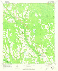
1971 Map of Alma NW
USGS Topo · Published 1974About this map
The lowlands of Big Satilla Creek dominate this landscape in Southeast Georgia, winding across the boundary between Appling and Bacon counties. Numerous small rural congregations dot the terrain, including Crosby Chapel, Corinth Ch, and Bethel Freewill Ch, indicating a community deeply rooted in its local parishes. The transition from agricultural land to wetland is marked by the presence of Black Water Creek and Bishop Creek, which drain into the larger Satilla basin.
Find a feature on this map
22 named features on this map. Tap any name to fly to it.
Don’t see what you’re looking for? This feature index may not catch every label — zoom into the map to look around manually.
Map Details
Editions of this 1971 Alma NW Map
This is the sole edition of this map. No revisions or reprints were ever made.
Other maps of this area

1953 · Waycross
USGS Topo · 1:250,000

1958 · Waycross
USGS Topo · 1:250,000

1970 · Pine Grove
USGS Topo · 1:24,000

1970 · Baxley
USGS Topo · 1:24,000

1971 · Nicholls NE
USGS Topo · 1:24,000

1971 · Coffee
USGS Topo · 1:24,000

1971 · Hazlehurst South
USGS Topo · 1:24,000

1971 · Alma
USGS Topo · 1:24,000

1971 · Sessoms
USGS Topo · 1:24,000
1971 · Alma NE
USGS Topo · 1:24,000