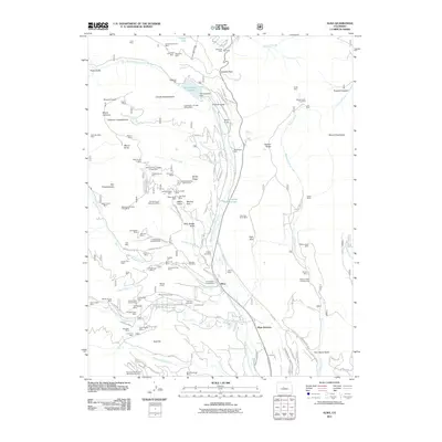
2011 Map of Alma
USGS Topo · Published 2011About this map
Alma and the high-altitude industrial landscape of the Mosquito Range define this study of the upper Middle Fork South Platte River drainage. The region is a dense network of nineteenth-century mining claims and modern water infrastructure, centered on the settlement of Alma and the nearby Alma Placer. High peaks such as Mount Lincoln and Mount Silverheels loom over narrow gulches filled with historical operations, including the Sweet Home Mine, Dolly Varden Mine, and the Magnolia Mill. Traces of earlier mountain communities remain at sites like Buckskin Cemetery and the Dudley Cemetery, while the Montgomery Reservoir and the Columbia Number 1 Ditch illustrate the complex water management required in this steep alpine environment. The presence of the Bristle Cone Pine Scenic Area along Windy Ridge highlights the unique botanical value of these high-elevation slopes alongside their deep mineral history.
Find a feature on this map
126 named features on this map. Tap any name to fly to it.
Don’t see what you’re looking for? This feature index may not catch every label — zoom into the map to look around manually.
Map Details
Editions of this 2011 Alma Map
This is the sole edition of this map. No revisions or reprints were ever made.
Other maps of this area

1889 · Leadville
USGS Topo · 1:125,000

1891 · Leadville
USGS Topo · 1:125,000

1934 · Climax
USGS Topo · 1:48,000

1937 · Como
USGS Topo · 1:62,500

1938 · Mt. Lincoln
USGS Topo · 1:48,000

1942 · Leadville
USGS Topo · 1:125,000

1945 · Mount Lincoln
USGS Topo · 1:62,500

1953 · Denver
USGS Topo · 1:250,000

1956 · Fairplay East
USGS Topo · 1:24,000

1957 · Denver
USGS Topo · 1:250,000