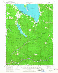
1955 Map of Almanor
USGS Topo · Published 1968About this map
Lake Almanor and the Butt Valley Reservoir dominate the high country of the Lassen National Forest in this mid-century survey. The landscape is a complex network of hydroelectric and mining infrastructure, featuring the Prattville Tunnel and numerous gaging stations alongside historic mountain settlements. Along the southern edge, the Western Pacific railroad follows the winding canyon of the North Fork Feather River, connecting small trackside communities like Virgilia, Twain, and Belden.
Find a feature on this map
120 named features on this map. Tap any name to fly to it.
Don’t see what you’re looking for? This feature index may not catch every label — zoom into the map to look around manually.
Map Details
Editions of this 1955 Almanor Map
4 editions found

Other maps of this area

1886 · Honey Lake
USGS Topo · 1:250,000

1886 · Lassen Peak
USGS Topo · 1:250,000

1888 · Bidwell Bar
USGS Topo · 1:125,000

1891 · Bidwell Bar
USGS Topo · 1:125,000

1891 · Downieville
USGS Topo · 1:125,000

1891 · Honey Lake
USGS Topo · 1:250,000

1892 · Lassen Peak
USGS Topo · 1:250,000

1893 · Bidwell Bar
USGS Topo · 1:125,000

1893 · Honey Lake
USGS Topo · 1:250,000

1893 · Downieville
USGS Topo · 1:125,000