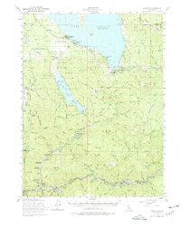
1955 Map of Almanor
USGS Topo · Published 1978About this map
Lake Almanor dominates this 1950s landscape, with its eastern shoreline subject to controlled inundation at Bunnel Point. Along the southern reaches, the North Fork Feather River and its steep tributaries like Mosquito Creek and Yellow Creek define the topography. Industrial activity is evident through the Western Pacific railroad line, which skirts the mountains near Dyer Mtn and Hauns Meadow. Settlement patterns are concentrated near the water at Prattville and Almanor, while further south, the Feather River corridor hosts narrow river towns including Virgilia, Belden, and Rich Bar. The map provides a detailed look at mid-century resource extraction, documenting several gold and mineral sites like the Grizzly Mine, Dutch Hill Mine, and Sunnyside Mine. Hydrological infrastructure is prominent, featuring the Almanor Intake Tower and the Surge Chamber near Caribou.
Find a feature on this map
100 named features on this map. Tap any name to fly to it.
Don’t see what you’re looking for? This feature index may not catch every label — zoom into the map to look around manually.
Map Details
Editions of this 1955 Almanor Map
4 editions found

Other maps of this area

1886 · Honey Lake
USGS Topo · 1:250,000

1886 · Lassen Peak
USGS Topo · 1:250,000

1888 · Bidwell Bar
USGS Topo · 1:125,000

1891 · Bidwell Bar
USGS Topo · 1:125,000

1891 · Downieville
USGS Topo · 1:125,000

1891 · Honey Lake
USGS Topo · 1:250,000

1892 · Lassen Peak
USGS Topo · 1:250,000

1893 · Bidwell Bar
USGS Topo · 1:125,000

1893 · Honey Lake
USGS Topo · 1:250,000

1893 · Downieville
USGS Topo · 1:125,000