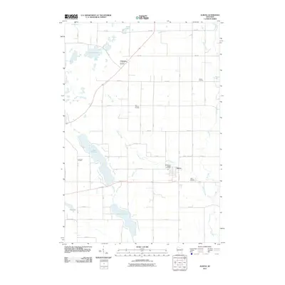
2010 Map of Almena
USGS Topo · Published 2010About this map
The village of Almena anchors the southeastern landscape of this Barron County region, where the grid of rural roads meets the winding path of Lightning Creek. The area is characterized by its glacial hydrology, featuring a chain of significant water bodies including Upper Turtle Lake, Lower Turtle Lake, and the smaller Mud Lake to the southwest. To the northwest, the settlement of Comstock sits near Crystal Lake, marking a distinct node in the local township structure.
Find a feature on this map
34 named features on this map. Tap any name to fly to it.
Don’t see what you’re looking for? This feature index may not catch every label — zoom into the map to look around manually.
Map Details
Editions of this 2010 Almena Map
This is the sole edition of this map. No revisions or reprints were ever made.
Other maps of this area

1950 · Turtle Lake
USGS Topo · 1:62,500

1951 · Cumberland
USGS Topo · 1:48,000

1951 · Shell Lake
USGS Topo · 1:48,000

1951 · Barron
USGS Topo · 1:62,500

1952 · Turtle Lake
USGS Topo · 1:62,500

1953 · Rice Lake
USGS Topo · 1:250,000

1953 · Stillwater
USGS Topo · 1:250,000

1955 · Stillwater
USGS Topo · 1:250,000

1956 · Cumberland
USGS Topo · 1:62,500

1958 · Stillwater
USGS Topo · 1:250,000