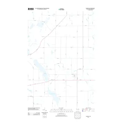
2013 Map of Almena
USGS Topo · Published 2013About this map
Upper Turtle Lake and Lower Turtle Lake anchor this portion of Barron County, where the landscape is defined by a dense concentration of glacial water bodies and a structured grid of agricultural roads. The Hay River meanders through the eastern section, joined by several smaller tributaries including Johnson Cr and Lightning Cr. This early 21st-century survey illustrates the modern layout of the rural area north of Almena, showcasing the intersection of major transit routes like Us-63 and Us-8 against a backdrop of numerous small lakes such as Crystal Lake, Gates Lake, and Echo Lake. The map reveals a high density of named water features, which suggests a region heavily utilized for recreation and conservation, while the road network remains tied to the underlying section lines of the original township surveys.
Find a feature on this map
53 named features on this map. Tap any name to fly to it.
Don’t see what you’re looking for? This feature index may not catch every label — zoom into the map to look around manually.
Map Details
Editions of this 2013 Almena Map
This is the sole edition of this map. No revisions or reprints were ever made.
Other maps of this area

1950 · Turtle Lake
USGS Topo · 1:62,500

1951 · Cumberland
USGS Topo · 1:48,000

1951 · Shell Lake
USGS Topo · 1:48,000

1951 · Barron
USGS Topo · 1:62,500

1952 · Turtle Lake
USGS Topo · 1:62,500

1953 · Rice Lake
USGS Topo · 1:250,000

1953 · Stillwater
USGS Topo · 1:250,000

1955 · Stillwater
USGS Topo · 1:250,000

1956 · Cumberland
USGS Topo · 1:62,500

1958 · Stillwater
USGS Topo · 1:250,000