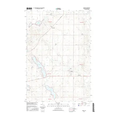
2015 Map of Almena
USGS Topo · Published 2015About this map
The Hay River and Lightning Cr drainage basins define the rural landscape of this western Wisconsin region, where agricultural road grids intersect with a dense network of glacial lakes and wetlands. The village of Almena serves as a central hub, situated near several community landmarks including Sacred Heart Cem and Saint Matthew Lutheran Cem. Further north, the settlement of Comstock sits near the shores of Crystal Lake, marking a transition toward more concentrated water bodies like Gates Lake and the winding Johnson Cr. The map preserves the specific locations of numerous denominational burial grounds, such as Zion Lutheran Cem and Bethany Cem, which offer significant value for genealogical research. The southern portion of the quadrangle is dominated by the connected waters of Upper Turtle Lake and Lower Turtle Lake, illustrating the complex hydrology that influenced the development of the village of Turtle Lake.
Find a feature on this map
48 named features on this map. Tap any name to fly to it.
Don’t see what you’re looking for? This feature index may not catch every label — zoom into the map to look around manually.
Map Details
Editions of this 2015 Almena Map
This is the sole edition of this map. No revisions or reprints were ever made.
Other maps of this area

1950 · Turtle Lake
USGS Topo · 1:62,500

1951 · Cumberland
USGS Topo · 1:48,000

1951 · Shell Lake
USGS Topo · 1:48,000

1951 · Barron
USGS Topo · 1:62,500

1952 · Turtle Lake
USGS Topo · 1:62,500

1953 · Rice Lake
USGS Topo · 1:250,000

1953 · Stillwater
USGS Topo · 1:250,000

1955 · Stillwater
USGS Topo · 1:250,000

1956 · Cumberland
USGS Topo · 1:62,500

1958 · Stillwater
USGS Topo · 1:250,000