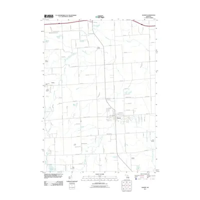
2011 Map of Almont
USGS Topo · Published 2011About this map
Almont and Dryden serve as the primary hubs in this corner of Lapeer County, where the agricultural landscape is drained by the Belle River and the North Branch Clinton River. The settlement pattern is characterized by a dense network of family-named roads, such as Sutton Rd, Ross Rd, and Hennesey Rd, which connect numerous rural burial grounds that speak to the area's pioneer heritage. These include the Scotch Settlement Cemetery and the Bethany Mennonite Cemetery, reflecting the diverse origins of early residents.
Find a feature on this map
99 named features on this map. Tap any name to fly to it.
Don’t see what you’re looking for? This feature index may not catch every label — zoom into the map to look around manually.
Map Details
Editions of this 2011 Almont Map
This is the sole edition of this map. No revisions or reprints were ever made.
Other maps of this area

1914 · Armada
USGS Topo · 1:62,500

1928 · Armada
USGS Topo · 1:62,500

1943 · Lake Orion
USGS Topo · 1:24,000

1943 · Romeo
USGS Topo · 1:24,000

1945 · Armada
USGS Topo · 1:24,000

1945 · Almont
USGS Topo · 1:24,000

1945 · Allenton
USGS Topo · 1:24,000

1945 · Thornville
USGS Topo · 1:24,000

1945 · Romeo
USGS Topo · 1:24,000
1945 · Lake Orion
USGS Topo · 1:24,000