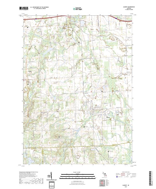
2023 Map of Almont
USGS Topo · Published 2023About this map
Almont and Dryden anchor this landscape where the headwaters of the Belle River and the North Branch Clinton River meet. The terrain is defined by a dense network of country roads and local drains, such as Heenan Drain and Weston Drain, reflecting a long history of agricultural management across Lapeer, Oakland, and Macomb counties. Genealogists will find a high concentration of burial sites, including the Bethany Mennonite Cem and Mount Pleasant Cem, often situated near early settlement nodes. Modern land use is visible in the presence of the Polly Ann State Trl, which follows a former transportation corridor through the village of Dryden. The map captures the meeting of several townships, including t7n r12e and t6n r11e, providing a clear view of the rural divisions and small water bodies like McNally Lake and O'Neil Lake that dot the countryside.
Find a feature on this map
112 named features on this map. Tap any name to fly to it.
Don’t see what you’re looking for? This feature index may not catch every label — zoom into the map to look around manually.
Map Details
Editions of this 2023 Almont Map
This is the sole edition of this map. No revisions or reprints were ever made.
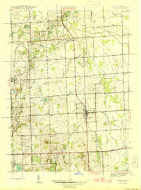
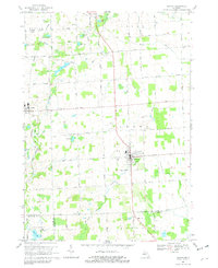
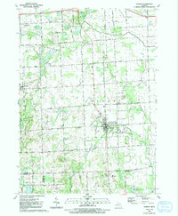
Historical Maps of Dryden Through Time
4 maps found