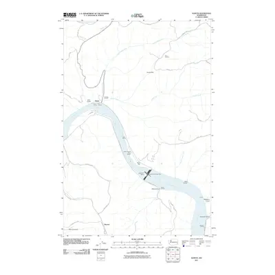
2011 Map of Almota
USGS Topo · Published 2011About this map
Snake River geography dominates this 2011 survey, showing the engineered landscape of the modern Pacific Northwest. The waterway is partitioned by the Lower Granite Lake Dam, creating distinct reservoirs known as Lake Bryan and Lower Granite Lake. Along these banks, industrial and recreational hubs like Port Almota, Boyer Marina, and Illia Landing reflect the river's role in local commerce and transport. Away from the water, the plateau includes the small settlement of Mayview and several family-named landmarks that point to the area's agricultural and pioneer history. Genealogists can find the Moys Cemetery and Spalding Cemetery positioned near the canyons. The rugged descent into the river valley is marked by dramatic terrain features such as Devils Slide and Stine Gulch, accessed by steep routes like Lambie Grade Rd and Wawawai Grade Rd.
Find a feature on this map
45 named features on this map. Tap any name to fly to it.
Don’t see what you’re looking for? This feature index may not catch every label — zoom into the map to look around manually.
Map Details
Editions of this 2011 Almota Map
This is the sole edition of this map. No revisions or reprints were ever made.
Other maps of this area

1910 · Pullman
USGS Topo · 1:125,000

1950 · Penawawa
USGS Topo · 1:62,500

1950 · Endicott
USGS Topo · 1:62,500

1955 · Pullman
USGS Topo · 1:250,000

1958 · Pullman
USGS Topo · 1:250,000

1964 · Wilcox
USGS Topo · 1:24,000

1964 · Kirby
USGS Topo · 1:24,000

1964 · Colfax South
USGS Topo · 1:24,000

1964 · Ewartsville
USGS Topo · 1:24,000

1964 · Bishop
USGS Topo · 1:24,000