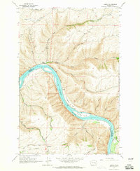
1964 Map of Almota
USGS Topo · Published 1965About this map
The Snake River carves a deep path through the plateau of southeastern Washington, separating Whitman and Garfield counties in this mid-1960s survey. The landscape is defined by steep descents from the high wheat-growing plains to the river floor, marked by a network of winding access routes including Almota Grade, Wawawai Grade, and Lambie Grade. Small river-bottom communities and landings like Almota and Wawawai are visible before the completion of Lower Granite Dam significantly altered the river's shoreline.
Find a feature on this map
39 named features on this map. Tap any name to fly to it.
Don’t see what you’re looking for? This feature index may not catch every label — zoom into the map to look around manually.
Map Details
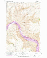
Editions of this 1964 Almota Map
2 editions found
Other maps of this area

1910 · Pullman
USGS Topo · 1:125,000

1950 · Penawawa
USGS Topo · 1:62,500

1950 · Endicott
USGS Topo · 1:62,500

1955 · Pullman
USGS Topo · 1:250,000

1958 · Pullman
USGS Topo · 1:250,000

1964 · Wilcox
USGS Topo · 1:24,000

1964 · Kirby
USGS Topo · 1:24,000

1964 · Colfax South
USGS Topo · 1:24,000

1964 · Ewartsville
USGS Topo · 1:24,000

1964 · Bishop
USGS Topo · 1:24,000