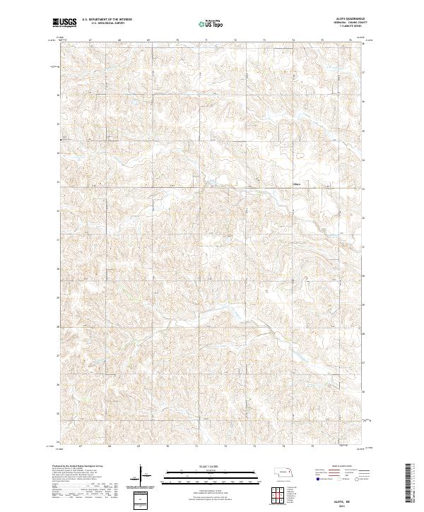
2021 Map of Aloys
USGS Topo · Published 2021About this map
Aloys serves as a central reference point in this agricultural landscape of Cuming County, where the drainage of Pebble Cr and its branches carves a rolling topography through the Nebraska prairie. The settlement pattern is defined by a rigorous section-line road grid, from C RD in the south to J RD at the northern edge, punctuated by rural landmarks such as Saint Peters Cem. This survey captures the specialized water network of the N Br Pebble Cr and the S Br Pebble Cr, illustrating the relationship between the natural creek bends and the straight-edged development of the surrounding farmland in the early 21st century.
Find a feature on this map
24 named features on this map. Tap any name to fly to it.
Don’t see what you’re looking for? This feature index may not catch every label — zoom into the map to look around manually.
Map Details
Editions of this 2021 Aloys Map
This is the sole edition of this map. No revisions or reprints were ever made.
Other maps of this area

1955 · Fremont
USGS Topo · 1:250,000

1957 · Fremont
USGS Topo · 1:250,000

1958 · Fremont
USGS Topo · 1:250,000

1963 · Wisner
USGS Topo · 1:24,000
1963 · Stanton NE
USGS Topo · 1:24,000

1966 · Monterey
USGS Topo · 1:24,000
1966 · Beemer
USGS Topo · 1:24,000

1966 · Snyder
USGS Topo · 1:24,000

1966 · Aloys
USGS Topo · 1:24,000

1966 · Clarkson
USGS Topo · 1:24,000