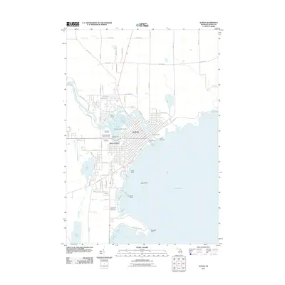
2011 Map of Alpena
USGS Topo · Published 2011About this map
Alpena's waterfront on Lake Huron is the focal point of this 2011 survey, showing the city's complex interface with Thunder Bay River and its various inlets. The map details a significant concentration of local heritage sites west of the city center, including a cluster of burial grounds such as Evergreen Cemetery, Hebrew Benevolent Society Cemetery, and Holy Cross Cemetery. This proximity of distinct cemeteries suggests the early multi-ethnic and multi-faith foundations of the settlement.
Find a feature on this map
79 named features on this map. Tap any name to fly to it.
Don’t see what you’re looking for? This feature index may not catch every label — zoom into the map to look around manually.
Map Details
Editions of this 2011 Alpena Map
This is the sole edition of this map. No revisions or reprints were ever made.
Other maps of this area

1954 · Tawas City
USGS Topo · 1:250,000

1954 · Alpena
USGS Topo · 1:250,000

1957 · Alpena
USGS Topo · 1:250,000

1958 · Alpena
USGS Topo · 1:250,000

1958 · Tawas City
USGS Topo · 1:250,000

1969 · Alpena
USGS Topo · 1:250,000

1971 · Lake Winyah
USGS Topo · 1:24,000

1971 · Long Lake West
USGS Topo · 1:24,000

1971 · Alpena
USGS Topo · 1:24,000

1971 · Middle Island
USGS Topo · 1:24,000