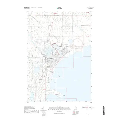
2019 Map of Alpena
USGS Topo · Published 2019About this map
Alpena's waterfront and industrial infrastructure define this modern survey of the Lake Huron shoreline. The Thunder Bay River winds through the city center past Cow Island, supporting a network of transport and industry visible in the tracks of the Lake State Railway and the busy Alpena Junction. The city's civic and social history is deeply represented through its cluster of burial grounds, including the Evergreen Cem, Pine Grove Cem, and the Hebrew Benevolent Society Cem, alongside the Alpena County Courthouse.
Find a feature on this map
92 named features on this map. Tap any name to fly to it.
Don’t see what you’re looking for? This feature index may not catch every label — zoom into the map to look around manually.
Map Details
Editions of this 2019 Alpena Map
This is the sole edition of this map. No revisions or reprints were ever made.
Other maps of this area

1954 · Tawas City
USGS Topo · 1:250,000

1954 · Alpena
USGS Topo · 1:250,000

1957 · Alpena
USGS Topo · 1:250,000

1958 · Alpena
USGS Topo · 1:250,000

1958 · Tawas City
USGS Topo · 1:250,000

1969 · Alpena
USGS Topo · 1:250,000

1971 · Lake Winyah
USGS Topo · 1:24,000

1971 · Long Lake West
USGS Topo · 1:24,000

1971 · Alpena
USGS Topo · 1:24,000

1971 · Middle Island
USGS Topo · 1:24,000