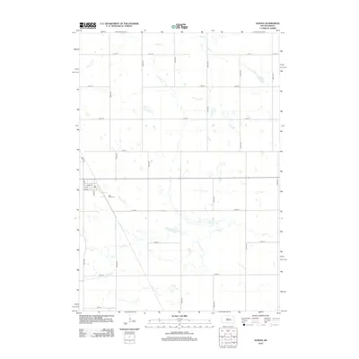
2012 Map of Alpena
USGS Topo · Published 2012About this map
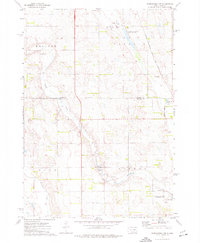
Alpena, South Dakota, occupies a landscape defined by its rigid section-line grid and the subtle meanders of prairie watercourses. The local street plan, centered on Main St and 2nd Ave, serves as the primary hub for this agricultural community. To the south, Rest Haven Cem provides a focal point for genealogical research, situated along the diagonal path of 392nd Ave. The terrain is characterized by the seasonal drainage patterns of Cain Cr in the north and the broader, more complex basin of Sand Cr that winds across the southern reaches. This modern survey, compiled from 2010 imagery, illustrates the enduring spatial organization of the Great Plains, where long avenues like 396th Ave and 398th Ave stretch across the open country, connecting isolated farmsteads to the central settlement.
Find a feature on this map
23 named features on this map. Tap any name to fly to it.
Don’t see what you’re looking for? This feature index may not catch every label — zoom into the map to look around manually.
Map Details
Editions of this 2012 Alpena Map
This is the sole edition of this map. No revisions or reprints were ever made.
Other maps of this area

1898 · Huron
USGS Topo · 1:125,000

1953 · Huron
USGS Topo · 1:250,000

1954 · Huron
USGS Topo · 1:250,000

1957 · Huron
USGS Topo · 1:24,000

1958 · Forestburg NW
USGS Topo · 1:24,000

1973 · Alpena
USGS Topo · 1:24,000
1973 · Forestburg SW
USGS Topo · 1:24,000
1973 · Woonsocket
USGS Topo · 1:24,000
1973 · Virgil
USGS Topo · 1:24,000
1973 · Woonsocket NW
USGS Topo · 1:24,000