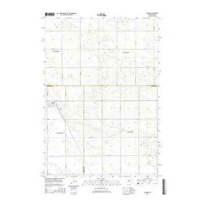
2015 Map of Alpena
USGS Topo · Published 2015About this map
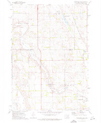
Alpena serves as the central hub of this agricultural landscape in the mid-2010s, situated near the intersection of several county lines. The town's grid is clearly defined by thoroughfares like Main St and 3rd St N, while Cemetery Rd leads south toward Rest Haven Cem. This survey illustrates the characteristic section-line road system of the Great Plains, where gravel and paved routes like Willow Ave and 392nd Ave divide the land into neat square miles. The terrain is marked by the winding paths of Sand Cr and Cain Cr, which carve subtle drainage patterns across the prairie. The map captures the precise jurisdictional boundaries where Beadle, Jerauld, and Sanborn counties meet, showing the localized geography of this rural South Dakota community.
Find a feature on this map
32 named features on this map. Tap any name to fly to it.
Don’t see what you’re looking for? This feature index may not catch every label — zoom into the map to look around manually.
Map Details
Editions of this 2015 Alpena Map
This is the sole edition of this map. No revisions or reprints were ever made.
Other maps of this area

1898 · Huron
USGS Topo · 1:125,000

1953 · Huron
USGS Topo · 1:250,000

1954 · Huron
USGS Topo · 1:250,000

1957 · Huron
USGS Topo · 1:24,000

1958 · Forestburg NW
USGS Topo · 1:24,000

1973 · Alpena
USGS Topo · 1:24,000
1973 · Forestburg SW
USGS Topo · 1:24,000
1973 · Woonsocket
USGS Topo · 1:24,000
1973 · Virgil
USGS Topo · 1:24,000
1973 · Woonsocket NW
USGS Topo · 1:24,000