2021 Map of Alpena
USGS Topo · Published 2021About this map
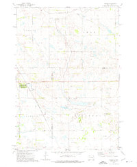
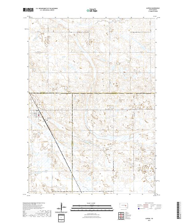
Alpena serves as the primary focal point of this South Dakota landscape, situated at the intersection of Jerauld, Beadle, and Sanborn counties. The town's grid is clearly defined, featuring a local Po and the Rest Haven - Alpena Cem just to the east. Historically tied to the rail lines that once traversed this region, the street plan includes Railroad Ave running parallel to the former tracks, while primary thoroughfares like Main St and 3rd St N organize the town center. The surrounding rural territory is dominated by section-line roads such as 217th St and 394th Ave, which carve through a prairie landscape dotted with seasonal wetlands and small watercourses. The drainage of the area is defined by Cain Cr in the north and the winding path of Sand Creek to the south.
Find a feature on this map
39 named features on this map. Tap any name to fly to it.
Don’t see what you’re looking for? This feature index may not catch every label — zoom into the map to look around manually.
Map Details
Editions of this 2021 Alpena Map
This is the sole edition of this map. No revisions or reprints were ever made.