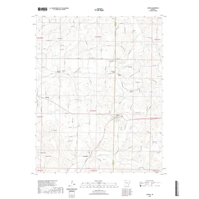
2020 Map of Alpena
USGS Topo · Published 2020About this map
Alpena serves as a central hub on this 2020 landscape, straddling the line between Carroll and Boone counties. The terrain is defined by a series of steep drainages and prominent ridges, including Pine Mtn and the steep elevations at Chaney Bluff and Ward Bluff. Small, traditional settlements such as Coin and Hough are scattered throughout the hills, connected by a network of winding roads like Co RD 835 and Co RD 811.
Find a feature on this map
118 named features on this map. Tap any name to fly to it.
Don’t see what you’re looking for? This feature index may not catch every label — zoom into the map to look around manually.
Map Details
Editions of this 2020 Alpena Map
This is the sole edition of this map. No revisions or reprints were ever made.
Other maps of this area

1904 · Harrison
USGS Topo · 1:125,000

1905 · Harrison
USGS Topo · 1:125,000

1945 · Harrison
USGS Topo · 1:250,000

1949 · Harrison
USGS Topo · 1:250,000

1954 · Harrison
USGS Topo · 1:250,000

1958 · Harrison
USGS Topo · 1:250,000

1964 · Harrison
USGS Topo · 1:250,000
1967 · Gaither
USGS Topo · 1:24,000
1967 · Omaha
USGS Topo · 1:24,000
1967 · Batavia
USGS Topo · 1:24,000