2024 Map of Alpena
USGS Topo · Published 2024About this map
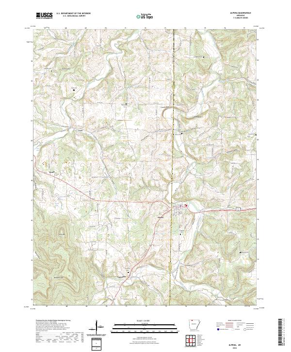
Alpena and the historic settlement of Carrollton anchor this Ozark landscape at the boundary of Carroll and Boone Counties. The terrain is defined by deeply incised hollows and prominent rises, including Pine Mtn and Bradfield Gap. The distribution of family and community burial grounds, such as Carrollton Cem, McCracken Cem, and the Youngblood Cem near the northern border, provides a detailed spatial record for genealogical research. Natural springs are a recurring feature of the topography, with Basin Spring, Bull Spring, and Tanyard Spring surfacing along the slopes west of town. The map documents the persistent rural character of Coin and Hough, while Long Creek and Terrapin Creek dictate the drainage patterns through the winding valleys. Economic activity is represented by the Rock Quarry near Oak Hills Cem, illustrating the local extraction industries that have long shaped the region's development.
Find a feature on this map
126 named features on this map. Tap any name to fly to it.
Don’t see what you’re looking for? This feature index may not catch every label — zoom into the map to look around manually.
Map Details
Editions of this 2024 Alpena Map
This is the sole edition of this map. No revisions or reprints were ever made.