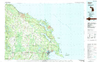
1984 Map of Alpena
USGS Topo · Published 1984About this map
Alpena and Rogers City anchor this coastal survey of Michigan’s northeastern shore along Lake Huron during the early 1980s. The landscape is defined by the heavy presence of the Mackinaw State Forest and a complex hydrological network including Grand Lake, Long Lake, and the sprawling Fletcher Pond. Along the jagged coastline, prominent features like Presque Isle, False Presque Isle, and Adams Point overlook a series of bays such as Thunder Bay and North Bay.
Find a feature on this map
100 named features on this map. Tap any name to fly to it.
Don’t see what you’re looking for? This feature index may not catch every label — zoom into the map to look around manually.
Map Details
Editions of this 1984 Alpena Map
This is the sole edition of this map. No revisions or reprints were ever made.
Other maps of this area

1954 · Traverse City
USGS Topo · 1:250,000

1954 · Tawas City
USGS Topo · 1:250,000

1954 · Alpena
USGS Topo · 1:250,000

1955 · Atlanta
USGS Topo · 1:62,500

1955 · Comins
USGS Topo · 1:62,500

1955 · Hillman
USGS Topo · 1:62,500

1955 · Cheboygan
USGS Topo · 1:250,000

1957 · Alpena
USGS Topo · 1:250,000

1957 · Onaway
USGS Topo · 1:62,500

1958 · Cheboygan
USGS Topo · 1:250,000