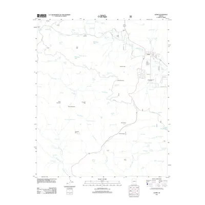
2011 Map of Alpine
USGS Topo · Published 2011About this map
Alpine sits at the high-elevation heart of this survey, where the San Francisco River begins its course amidst a landscape defined by volcanic landforms and specialized water management. The settlement is flanked by prominent heights like Tenney Mountain and South Mountain, with the surrounding territory heavily marked by several dozen named earthen tanks and springs, such as Sulzberger Tank and Williams Valley Spring. These features underscore the importance of water storage in this corner of the state.
Find a feature on this map
106 named features on this map. Tap any name to fly to it.
Don’t see what you’re looking for? This feature index may not catch every label — zoom into the map to look around manually.
Map Details
Editions of this 2011 Alpine Map
This is the sole edition of this map. No revisions or reprints were ever made.
Other maps of this area

1922 · Nutrioso
USGS Topo · 1:125,000

1954 · Clifton
USGS Topo · 1:250,000

1957 · Clifton
USGS Topo · 1:250,000

1958 · Clifton
USGS Topo · 1:250,000

1958 · Alpine
USGS Topo · 1:62,500

1958 · Hannagan Meadow
USGS Topo · 1:62,500

1958 · Big Lake
USGS Topo · 1:62,500

1961 · Blue
USGS Topo · 1:62,500

1962 · Clifton
USGS Topo · 1:250,000
1981 · Nutrioso
USGS Topo · 1:100,000