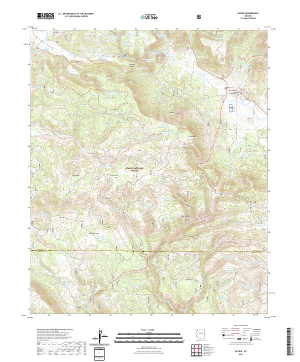
2021 Map of Alpine
USGS Topo · Published 2021About this map
The settlement of Alpine sits at the high eastern edge of the Apache National Forest, where the headwaters of the San Francisco River wind through the mountain landscape. This area is characterized by high-elevation meadows and peaks, including South Mtn and Tenny Mtn, punctuated by natural drainage features like Spit Sink and DT Sink. The land use is defined by a extensive system of water management tanks, such as Williams Tank and Timber Bench Tank, which support the livestock and wildlife within the national forest boundaries. A sophisticated network of recreational trails, including the Valley Bike Trl and Lookout Meadow Loop Trl, crisscrosses Williams Valley, indicating the transition of this traditional mountain community toward seasonal recreation and forest management. The presence of numerous family-named landmarks like Bennys Tank and Georges Tank reflects the long-standing ranching history of the Apache County high country.
Find a feature on this map
105 named features on this map. Tap any name to fly to it.
Don’t see what you’re looking for? This feature index may not catch every label — zoom into the map to look around manually.
Map Details
Editions of this 2021 Alpine Map
This is the sole edition of this map. No revisions or reprints were ever made.
Other maps of this area

1922 · Nutrioso
USGS Topo · 1:125,000

1954 · Clifton
USGS Topo · 1:250,000

1957 · Clifton
USGS Topo · 1:250,000

1958 · Clifton
USGS Topo · 1:250,000

1958 · Alpine
USGS Topo · 1:62,500

1958 · Hannagan Meadow
USGS Topo · 1:62,500

1958 · Big Lake
USGS Topo · 1:62,500

1961 · Blue
USGS Topo · 1:62,500

1962 · Clifton
USGS Topo · 1:250,000
1981 · Nutrioso
USGS Topo · 1:100,000