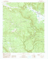
1991 Map of Alpine
USGS Topo · Published 1991About this map
The settlement of Alpine serves as the primary hub in this high-altitude corner of the Apache National Forest, situated where the San Francisco River meets Judd Lake. In the late 20th century, this area maintained its character as a mountain community defined by its proximity to the wilderness and traditional land uses, including the Rodeo Ground and a Ranger Station on the town's edge. The surrounding terrain is a complex of significant peaks and drainages, notably South Mountain and Tenney Mountain, which feed numerous waterways like Coyote Creek and Turkey Creek.
Find a feature on this map
31 named features on this map. Tap any name to fly to it.
Don’t see what you’re looking for? This feature index may not catch every label — zoom into the map to look around manually.
Map Details
Editions of this 1991 Alpine Map
This is the sole edition of this map. No revisions or reprints were ever made.
Other maps of this area

1922 · Nutrioso
USGS Topo · 1:125,000

1954 · Clifton
USGS Topo · 1:250,000

1957 · Clifton
USGS Topo · 1:250,000

1958 · Clifton
USGS Topo · 1:250,000

1958 · Alpine
USGS Topo · 1:62,500

1958 · Hannagan Meadow
USGS Topo · 1:62,500

1958 · Big Lake
USGS Topo · 1:62,500

1961 · Blue
USGS Topo · 1:62,500

1962 · Clifton
USGS Topo · 1:250,000
1981 · Nutrioso
USGS Topo · 1:100,000