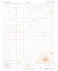
1957 Map of Alpine Butte
USGS Topo · Published 1975About this map
Alpine Butte rises sharply above the high desert floor in this 1950s era survey of Los Angeles County, which was updated in the mid-1970s to reflect localized developments. The landscape is defined by a rigid grid of thoroughfares, including East Avenue F and 140th Street East, crossing an arid expanse dotted with numerous wells and reservoirs. These water features indicate the intensive effort required to support habitation and agricultural potential in this dry climate.
Find a feature on this map
24 named features on this map. Tap any name to fly to it.
Don’t see what you’re looking for? This feature index may not catch every label — zoom into the map to look around manually.
Map Details
Editions of this 1957 Alpine Butte Map
4 editions found
Other maps of this area

1915 · Elizabeth Lake
USGS Topo · 1:125,000

1917 · Elizabeth Lake
USGS Topo · 1:125,000

1930 · Joshua
USGS Topo · 1:24,000

1930 · Lovejoy Springs
USGS Topo · 1:24,000

1930 · Roosevelt School
USGS Topo · 1:24,000

1930 · Casa Desierta
USGS Topo · 1:24,000

1930 · West Alpine Butte
USGS Topo · 1:24,000

1930 · Tierra Bonita
USGS Topo · 1:24,000

1933 · Casa Desierta
USGS Topo · 1:24,000

1933 · Lovejoy Springs
USGS Topo · 1:24,000