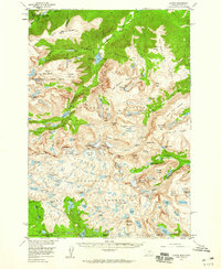
1956 Map of Alpine
USGS Topo · Published 1960About this map
The Mystic Lake Hydroelectric Plant stands as a primary industrial landmark in this high-altitude landscape where Stillwater and Carbon Counties meet. This mid-century survey captures a region defined by the intersection of three major protected areas: Custer National Forest, Gallatin National Forest, and Shoshone National Forest. The map documents a complex drainage system flowing through the Beartooth Plateau, where numerous glacial remnants such as the Sundance Glacier and Castle Rock Glacier feed into water bodies like East Rosebud Lake and Rainbow Lake. At Alpine, the road network terminates, giving way to the high peaks of the Silver Run Plateau. The topography shows a transition from the lower valleys to extreme elevations, marked by Whitetail Peak and Mount Rearguard along the Montana-Wyoming border.
Find a feature on this map
118 named features on this map. Tap any name to fly to it.
Don’t see what you’re looking for? This feature index may not catch every label — zoom into the map to look around manually.
Map Details
Editions of this 1956 Alpine Map
3 editions found

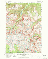
Other maps of this area

1896 · Crandall Creek
USGS Topo · 1:125,000

1898 · Granite Mountain District
USGS Topo · 1:125,000

1899 · Crandall
USGS Topo · 1:125,000

1932 · Red Lodge No 2
USGS Topo · 1:48,000

1932 · Nye No 1
USGS Topo · 1:48,000

1932 · Nye No 2
USGS Topo · 1:48,000

1939 · Mt Wood
USGS Topo · 1:62,500

1941 · Mt. Wood
USGS Topo · 1:62,500

1950 · Deep Lake
USGS Topo · 1:62,500

1954 · Billings
USGS Topo · 1:250,000