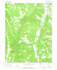
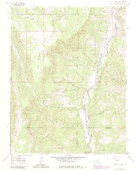
1963 Map of Alpine Plateau
USGS Topo · Published 1966About this map
The Lake Fork Gunnison River carves a deep path through the high country on the boundary of Gunnison National Forest and Uncompahgre National Forest in the early 1960s. This survey records a landscape shaped by both natural drainage and early ranching, centered on the Alpine Plateau. Settlement is sparse, represented by established family holdings like the Thomas Ranch, Thompson Ranch, and Ute Trail Ranch. A small Cem located near the river suggests the long-standing presence of these families in the valley.
Find a feature on this map
37 named features on this map. Tap any name to fly to it.
Don’t see what you’re looking for? This feature index may not catch every label — zoom into the map to look around manually.
Map Details
Editions of this 1963 Alpine Plateau Map
5 editions found
Other maps of this area

1903 · Lake City
USGS Topo · 1:62,500

1905 · Lake City
USGS Topo · 1:62,500

1908 · Uncompahgre
USGS Topo · 1:125,000

1911 · Uncompahgre
USGS Topo · 1:125,000

1954 · Gateview
USGS Topo · 1:24,000

1956 · Montrose
USGS Topo · 1:250,000

1959 · Montrose
USGS Topo · 1:250,000

1960 · Montrose
USGS Topo · 1:250,000
1963 · Sheep Mountain
USGS Topo · 1:24,000
1963 · Lake City
USGS Topo · 1:24,000