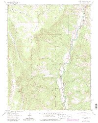
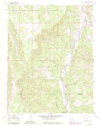
1963 Map of Alpine Plateau
USGS Topo · Published 1984About this map
The Lake Fork Gunnison River carves a deep valley through this high-altitude landscape, serving as the primary corridor for movement and settlement. Along its banks, established homesteads such as Wilson Ranch, Thomas Ranch, and Ute Trail Ranch illustrate the mid-century ranching footprint in this remote stretch of Colorado. High above the river, the Alpine Plateau and the peaks of Baldy dominate the terrain, while the Pack Driveway and several Jeep Trails suggest the persistent use of seasonal routes for livestock and access. Water management is a key feature of the valley floor, evidenced by the No 2 Thompson Ditch near Thompson Ranch. This 1963 survey, later updated in the early 1980s, documents the area just as the Big Blue Wilderness was being defined within the broader Uncompahgre National Forest, capturing a moment before modern recreation heavily altered these traditional working landscapes.
Find a feature on this map
46 named features on this map. Tap any name to fly to it.
Don’t see what you’re looking for? This feature index may not catch every label — zoom into the map to look around manually.
Map Details
Editions of this 1963 Alpine Plateau Map
5 editions found
Other maps of this area

1903 · Lake City
USGS Topo · 1:62,500

1905 · Lake City
USGS Topo · 1:62,500

1908 · Uncompahgre
USGS Topo · 1:125,000

1911 · Uncompahgre
USGS Topo · 1:125,000

1954 · Gateview
USGS Topo · 1:24,000

1956 · Montrose
USGS Topo · 1:250,000

1959 · Montrose
USGS Topo · 1:250,000

1960 · Montrose
USGS Topo · 1:250,000
1963 · Sheep Mountain
USGS Topo · 1:24,000
1963 · Lake City
USGS Topo · 1:24,000