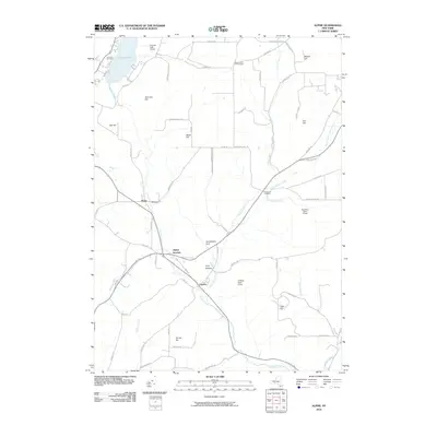
2010 Map of Alpine
USGS Topo · Published 2010About this map
Cayuta Lake and its surrounding hills dominate the northern landscape of this region, which is defined by the steep-walled valleys of The Gulf and Hendershot Gulf. The settlement at Alpine and the nearby Alpine Junction serve as local hubs in a landscape heavily protected by conservation lands, including Cliffside State Forest and Newfield State Forest. For the family historian, the map includes several isolated burial sites such as Lawrence Cemetery, Estabrook Cemetery, and Connecticut Hill Cemetery, reflecting the long-established rural community. The drainage of Cayuta Creek and its many tributaries, like Pony Hollow Creek and Chaffee Creek, shows a complex hydraulic pattern that influenced the placement of early homesteads and roads through the rugged topography of Oak Hill and Irish Hill.
Find a feature on this map
70 named features on this map. Tap any name to fly to it.
Don’t see what you’re looking for? This feature index may not catch every label — zoom into the map to look around manually.
Map Details
Editions of this 2010 Alpine Map
This is the sole edition of this map. No revisions or reprints were ever made.
Other maps of this area

1893 · Ithaca
USGS Topo · 1:62,500

1895 · Ithaca
USGS Topo · 1:62,500

1895 · Elmira
USGS Topo · 1:62,500

1898 · Watkins Glen
USGS Topo · 1:62,500

1901 · Watkins
USGS Topo · 1:62,500

1902 · Waverly
USGS Topo · 1:62,500

1905 · Watkins Glen
USGS Topo · 1:125,000

1949 · Ithaca West
USGS Topo · 1:24,000

1950 · Elmira
USGS Topo · 1:250,000

1950 · Alpine
USGS Topo · 1:24,000