2013 Map of Alpine
USGS Topo · Published 2013About this map
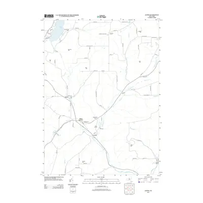
Cayuta Lake anchors the northwestern corner of this landscape, its shores home to the Cool Lea Campground and Kayutah Lake Airport. The terrain is defined by a series of prominent elevations including Oak Hill, VanLone Hill, and Swan Hill, which dictate the winding paths of rural routes like Connecticut Hill Rd and Summerton Hill Rd. Small settlements such as Alpine, Alpine Junction, and Cayuta are situated along the valley floors where drainage systems like Cayuta Cr and Pony Hollow Cr converge. Genealogists will find historical value in the presence of several community burial grounds, including Lawrence Cem, Connecticut Hill Cem, and Estabrook Cem, which are tucked away near these early population centers. Distinctive geological features such as The Gulf and Hendershot Gulf break the upland plateaus, marking the sharp descents into the surrounding hollows like Pony Hollow and Cornish Hollow.
Find a feature on this map
79 named features on this map. Tap any name to fly to it.
Don’t see what you’re looking for? This feature index may not catch every label — zoom into the map to look around manually.
Map Details
Editions of this 2013 Alpine Map
This is the sole edition of this map. No revisions or reprints were ever made.
Other maps of this area

1893 · Ithaca
USGS Topo · 1:62,500

1895 · Ithaca
USGS Topo · 1:62,500

1895 · Elmira
USGS Topo · 1:62,500

1898 · Watkins Glen
USGS Topo · 1:62,500

1901 · Watkins
USGS Topo · 1:62,500

1902 · Waverly
USGS Topo · 1:62,500

1905 · Watkins Glen
USGS Topo · 1:125,000

1949 · Ithaca West
USGS Topo · 1:24,000

1950 · Elmira
USGS Topo · 1:250,000

1950 · Alpine
USGS Topo · 1:24,000