
1972 Map of Alpine South
USGS Topo · Published 1975About this map
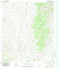
The high-desert hub of Alpine is captured here during the early 1970s, serving as a vital intersection of education, ranching culture, and transportation. The street grid extends southward toward Alpine Hill, anchored by the sprawling campus of Sul Ross State University and local landmarks like Centennial High Sch and Jackson Field. The town’s recreational and social character is evident in the inclusion of the Rodeo Ground, Kokernot Muni Park, and the Drive-in Theater on the western edge.
Find a feature on this map
63 named features on this map. Tap any name to fly to it.
Don’t see what you’re looking for? This feature index may not catch every label — zoom into the map to look around manually.
Map Details
Editions of this 1972 Alpine South Map
This is the sole edition of this map. No revisions or reprints were ever made.
Other maps of this area

1895 · Alpine
USGS Topo · 1:125,000

1954 · Fort Stockton
USGS Topo · 1:250,000

1958 · Fort Stockton
USGS Topo · 1:250,000

1972 · Bird Mountain
USGS Topo · 1:24,000

1972 · Alpine North
USGS Topo · 1:24,000

1972 · Paisano
USGS Topo · 1:24,000

1972 · Mitre Peak
USGS Topo · 1:24,000

1972 · Elam Mountain
USGS Topo · 1:24,000

1973 · Fort Stockton
USGS Topo · 1:250,000
1983 · Mount Ord
USGS Topo · 1:24,000